Le Rœulx
Appearance
Le Rœulx
El Rû (Walloon) | |
|---|---|
 | |
| Coordinates: 50°30′N 04°06′E / 50.500°N 4.100°E | |
| Community | French community |
| Region | Wallonia |
| Province | Hainaut |
| Arrondissement | Soignies |
| Government | |
| • Mayor | Benoît Friart |
| • Governing party/ies | IC |
| Area | |
| • Total | 43.41 km2 (16.76 sq mi) |
| Population (2018-01-01)[1] | |
| • Total | 8,617 |
| • Density | 200/km2 (510/sq mi) |
| Postal codes | 7070 |
| NIS code | 55035 |
| Area codes | 064 |
| Website | www.leroeulx.be |
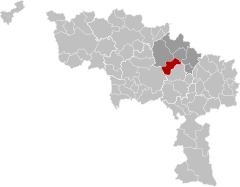
Le Rœulx (French pronunciation: [lə ʁø] ; Walloon: El Rû) is a city and municipality of Wallonia located in the province of Hainaut, Belgium.
On January 1, 2006, Le Rœulx had a total population of 7,977. The total area is 42.80 km2 which gives a population density of 186 inhabitants per km2.
The municipality consists of the following districts: Gottignies, Le Rœulx, Mignault, Thieu, and Ville-sur-Haine.
The Château du Rœulx, a family seat of the Comtes de Croÿ-Rœulx, is situated near the town.

References
[edit]- ^ "Wettelijke Bevolking per gemeente op 1 januari 2018". Statbel. Retrieved 9 March 2019.
External links
[edit] Media related to Le Roeulx at Wikimedia Commons


